
 By Sylvia Dorrance, REALTOR®, eXp Realty
What the Greenbelt is
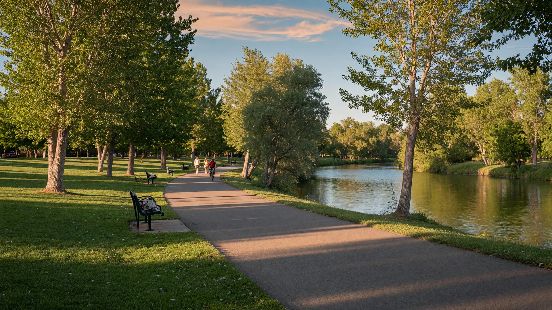
The City of Boise describes the Greenbelt as a 29-mile tree-lined pathway that follows the north and south sides of the Boise River through the heart of the city. Its eastern end is at Lucky Peak and it runs west to Eagle, passing through Boise and Garden City along the way. It is one of the defining features of outdoor life in the Boise area: a continuous paved route where you can walk, run, or ride for miles along the water without sharing the road with cars. The City also describes it as providing scenic views, wildlife habitat, and pedestrian access to many of Boise's popular parks. The pathway connects parks, neighborhoods, and parts of downtown, and the full route now runs as one connected, multi-jurisdiction system.
How it is managed
Sections are managed by the City of Boise, Ada County, Garden City, the City of Eagle, and the Idaho Foundation for Parks and Lands, each in its own area. That partnership keeps the pathway connected across city and county lines, which is why a single ride can start at Lucky Peak and continue well past the city limits without a gap. Ada County Parks and Waterways alone manages more than 11 miles of the system. For residents, the practical effect is a maintained, connected trail rather than a patchwork of separate paths, and the shared management is also why conditions and improvements can vary slightly from one stretch to the next.
Parks along the river
The pathway passes several of Boise's major parks, each with its own character.
- Kathryn Albertson Park: a landscaped park with ponds, wildlife, and quiet walking paths, west of downtown across from Ann Morrison Park. The City of Boise calls it a 41-acre haven for wildlife and quiet contemplation, with wide, paved footpaths in a natural setting. Biking, fishing, boating, swimming, and wading are not allowed in the park, which keeps it quiet.
- Ann Morrison Park: wide-open lawns along the river in central Boise, a favorite for picnics and sports, and the traditional finish for summer river floats.
- Julia Davis Park: downtown's central green space, with gardens, tree-lined paths, and museums within the park. The Boise Art Museum, the Idaho State Museum, and the Idaho Black History Museum sit inside it, along with the rose garden and Zoo Boise.
- Esther Simplot Park: a newer riverfront park with ponds, meadows, and walking paths.
- Barber Park: a riverside park east of downtown that serves as a launch point for summer floating, with parking and river access.
Each park has its own page on the City of Boise site with details on amenities, access, and the rules that apply there.
How people use it
The Greenbelt is both a recreation trail and a commute route. Morning commuters ride it toward offices downtown, walkers head out on weekend mornings, and runners and cyclists log steady miles along it. It also connects to neighborhood paths, so some homes along the river have a direct route to the trail without crossing traffic. On any given day you will see walkers, runners, cyclists, dog walkers, and people fishing or reading by the water. The path's gentle grade also makes it an option for runners of all levels. The mix changes with the season: summer brings floaters and full parking lots at the launch points, while fall and winter are quieter and the path stays open year-round.
What to know about access
The way a home reaches the Greenbelt matters more than its distance on a map. Some neighborhoods connect by a quiet path or a short street, while others sit across a busier road. When you are considering a home near the river, it is worth walking the route yourself, at the time of day you would actually use it, before you decide how much the location is worth to you. A home that is technically close to the river can still have a very different daily experience from one with a direct, safe connection to the trail.
Greenbelt etiquette and rules
The Greenbelt is a shared path, and the rules keep it that way. Boise's parks code prohibits smoking and vaping in all City of Boise parks, including within 20 feet of the Greenbelt, with limited designated exceptions in Ann Morrison and Julia Davis parks and at city-owned golf courses. Leash rules vary by park and pathway section, so check the posted rules where you start. Cyclists and walkers share the same pavement, so the working expectation is to pass on the left and keep the path clear. The City posts its full parks code online, and each park page lists the rules that apply at that stop.
The Greenbelt beyond Boise
West of the Boise city limits, the route continues through Garden City and on to Eagle as one connected pathway. Garden City treats the Greenbelt and its pathways as a top priority, and its parks page describes the improvements the city has completed along the river, including the south-side section between 44th and 49th Streets. Riverfront Park sits along the path at the north end of 42nd Street and connects the trail to playgrounds and picnic areas. Farther west, the City of Eagle maintains its own trails and pathways along the river, and its parks department publishes a map of the Eagle Greenbelt. The City of Boise describes the full run from Lucky Peak to Eagle as the product of a partnership among all the jurisdictions that manage it. That means homes in Eagle, as well as in Boise, can have the same kind of riverfront trail access.
Sylvia's take
If you're drawn to the river, look at how a home actually reaches the Greenbelt. A short walk down a quiet street is different from crossing a busy road. I'm happy to map the route from any home you're considering.
Frequently asked questions
How long is the Boise River Greenbelt?
29 miles, tree-lined, along both sides of the Boise River from Lucky Peak to Eagle, through Boise and Garden City.
Who manages the Greenbelt?
Sections are managed by the City of Boise, Ada County, Garden City, the City of Eagle, and the Idaho Foundation for Parks and Lands, each in its own area.
Can you commute on the Greenbelt?
Yes. Many people ride or walk to work and school, and the pathway has access points from many neighborhoods along the river.
Which parks are on the Greenbelt?
Kathryn Albertson, Ann Morrison, Julia Davis, Esther Simplot, Barber, and more along the river.
Idaho License #9671048.
Equal Housing Opportunity.