
 By Sylvia Dorrance, REALTOR®, eXp Realty
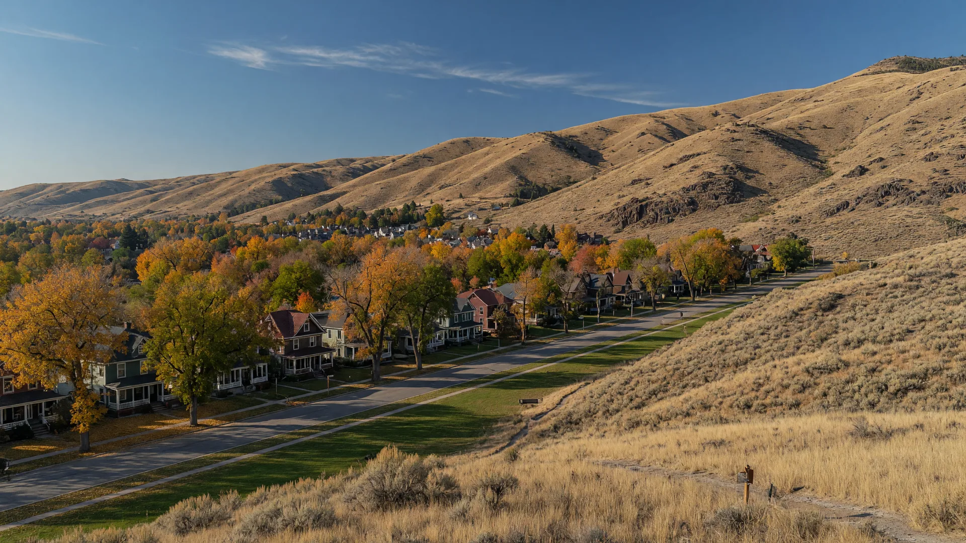
Choosing between the Boise Foothills and the North End is really a choice between two different visions of living in the Boise area, known locally as the Treasure Valley. The two places are close on a map and far apart in character. The Foothills are defined by open space, elevation, and views, with development rules shaped around the land itself. The North End is defined by age, history, and walkability, a neighborhood built when the city was young. Neither is better; they are simply different, and the difference shows in everything from lot size to street trees.
Where they are
The Foothills Planning Area covers the hills that rise above the city, where housing sits among preserved open space and much of the land above the homes is public. The North End begins just north of downtown and runs up toward the foothills themselves: it is the older, flatter part of the city where the street grid meets the hill.
Open space in the Foothills
Open space has been a deliberate part of the Boise experience for generations, and the record is public. The City of Boise owns and manages 15 open space reserves totaling about 5,000 acres, including Camel's Back, Hulls Gulch, and Military Reserve. In November 2015, Boise voters approved a $10 million Open Space and Clean Water levy supporting preservation in the Foothills, along the river, and at open space sites throughout the city. The Open Space Reserve Management Plan provides the long-term strategy for these lands. For home buyers, the practical effect is that much of the land around Foothills homes is permanently preserved, which protects views and trail access but also means fewer new roads and a permanent wildland edge.
Trails and recreation
The Ridge to Rivers trail system is the thread that ties Foothills neighborhoods together. It is managed through a multi-agency partnership that includes the Bureau of Land Management, the City of Boise, Ada County Parks and Waterways, the Boise National Forest, and the Idaho Department of Fish and Game, with the City of Boise serving as the lead. The system includes more than 190 miles of trail. The North End, by contrast, sits closer to downtown parks and the Boise River Greenbelt, and its recreation is more urban: neighborhood parks, the river path, and Camel's Back Park, where the Foothills trails begin at the edge of the old neighborhood.
Development rules in the Foothills
The Foothills Planning Area has its own chapter in Boise City Code. The Foothills Planned Development Standards exist to implement the residential density and design elements of the Comprehensive Plan in the Foothills, and to protect and promote preservation of contiguous open space. Part of the system is a density bonus: development that preserves eligible open space can earn additional units, while steep slopes and sensitive lands are built at far lower densities. The result is visible today: newer subdivisions tucked against reserves, large lots on the hillsides, and long stretches of road with no houses at all.
The North End's history
Part of the North End is the North End Historic District, the city's first suburban development. Its first neighborhood was platted in 1878, a small area between 9th and 13th streets from Fort to Resseguie. An early pattern of leapfrog development left vacant lots that were later filled with contemporary styles, so the district today mixes simple clapboard dwellings, Queen Anne, Bungalow, and Tudor Revival homes. It was an early trolley neighborhood, and the lasting legacy is visible in its layout: a grid of streets with rear alleys, generous landscaped parkways, and deciduous trees that unify the district, per the city's design guidelines. For homes inside the historic district's boundaries, exterior changes go through the city's design review, which protects what makes the neighborhood what it is; homes outside the boundaries are not subject to that review. Check the city's district map for a specific address.
Homes and lots
In the Foothills, most housing was built in the last few decades: newer construction, larger lots, attached garages, and homes designed to take in views and morning sun. In the North End, homes range from the 1880s through recent infill, sit on narrow lots, and often park in garages reached from the alley rather than the street. Age is not a verdict on condition: a century-old North End home with updated systems can be a better buy than a newer home that has not been maintained.
Trees, sidewalks, and streets
The differences in streets are the easiest to see. The North End has mature canopies, parkway medians, and continuous sidewalks; trees decades old arch over the blocks. Foothills streets are newer, built by ACHD as each subdivision went in, and the trees are younger. Ada County's roads are built and maintained by ACHD either way, which plans bicycle facilities as part of every roadway project, so both areas have bike access, but the North End's grid connects on foot to downtown while Foothills travel is almost entirely by car.
Fire and defensible space
Homes built against preserved open space sit at a wildland edge, and the Ask Sylvia answer on defensible space explains what that means in practical terms: managing vegetation, spacing, and materials around the home. This is a permanent feature of Foothills living, worth understanding before choosing the view.
Foothills vs. North End
| Category | Boise Foothills | North End |
|---|---|---|
| Housing age | Mostly newer construction | 1880s through recent infill |
| Lot sizes | Larger lots, hillside sites | Narrow lots, alley access |
| Streets | Newer, built with subdivisions | Historic grid, parkway medians, rear alleys |
| Trees | Younger, maturing | Mature canopies |
| Open space | 15 city reserves, 5,000 acres | Neighborhood parks, river greenbelt nearby |
| Recreation | Ridge to Rivers trails, 190+ miles | Walkable grid, parks, river path |
| Rules | Foothills development standards | Design review inside historic district boundaries |
The takeaway
The Foothills and the North End both put outdoor life at the center of the day, but in opposite ways: one through preserved open space and trailheads, the other through a walkable historic street grid. The deciding questions are about the places themselves, how new a home you want, how much yard, whether you want alleys and sidewalks or views and trails, and whether a historic district's design process fits your plans.
Sylvia's take
Drive both on a Sunday morning. The Foothills feels like the mountains came to you; the North End feels like the city stayed small. One of them will feel like home, and that one is usually right.
Frequently asked questions
How much open space does the City of Boise manage in the Foothills?
The city owns and manages 15 open space reserves totaling about 5,000 acres, funded in part by voter-approved levies. (Source: City of Boise)
Who manages the Foothills trails?
Ridge to Rivers, a partnership led by the City of Boise with the BLM, Ada County, the Boise National Forest, and Idaho Fish and Game, manages more than 190 miles of trail.
Is the North End a historic district?
Part of the North End is a designated historic district; design review applies only to properties inside its boundaries. Check the city's district map for the exact address.
Do Foothills homes have different development rules?
Yes. The Foothills Planning Area has its own standards in Boise City Code designed to shape density and preserve open space.